
From The National Weather Service –
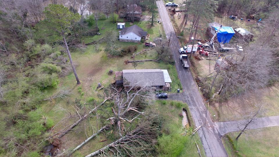
Damage surveys and close examination of radar data confirm that a significant downburst occurred near Cedartown GA beginning at approximately 12:32 PM on Thursday March 25, 2021 resulting in widespread wind damage on the East and Southeast side of town.
The center of the downburst was located in a heavily wooded area east of Main Street and south of HWY 278. Numerous downed trees south of HWY 27 along Tuck Street are snapped or blown down and facing south away from the downburst area. Numerous trees were snapped or uprooted along East Point Road north of HWY 278 and are facing north or northwest away from the center of the downburst.
Forward momentum of the storm and strong winds continued east and southeast of HWY 27, snapping and uprooting trees along Lees Chapel Road, Friendly Baptist Road, and Coaling Road in a east or northeast direction. Numerous homes in the area sustained wind damage to their roofs due to downed trees and or shingle damage from the strong winds. A second smaller downburst occurred north of this area, to the west of Cedartown High School and north of East Avenue.
Trees were uprooted facing east-northeast throughout the school property and several air conditioning systems were moved on the roof of the admin building.
In addition, numerous trees were uprooted or snapped in the Northview Cemetery facing southeast away from the second downburst location. A detailed examination of radar data confirms a MARC (Mid Altitude Radial Convergence) signature present at the time of the storm, which is indicative of storms capable of producing a strong downburst.